News 3 min read
We've always been about knowing what the road looks like before you set off. Speed cameras are part of that picture, so we've added them as another layer on the map you already use: a speed camera map with no clutter and no adverts getting in the way.
Switch on the speed camera map
Open the map and tap the speed camera button, the round one with "30" in it, next to the traffic cameras button. That's it. The speed camera map remembers your choice, so they'll be there next time too.
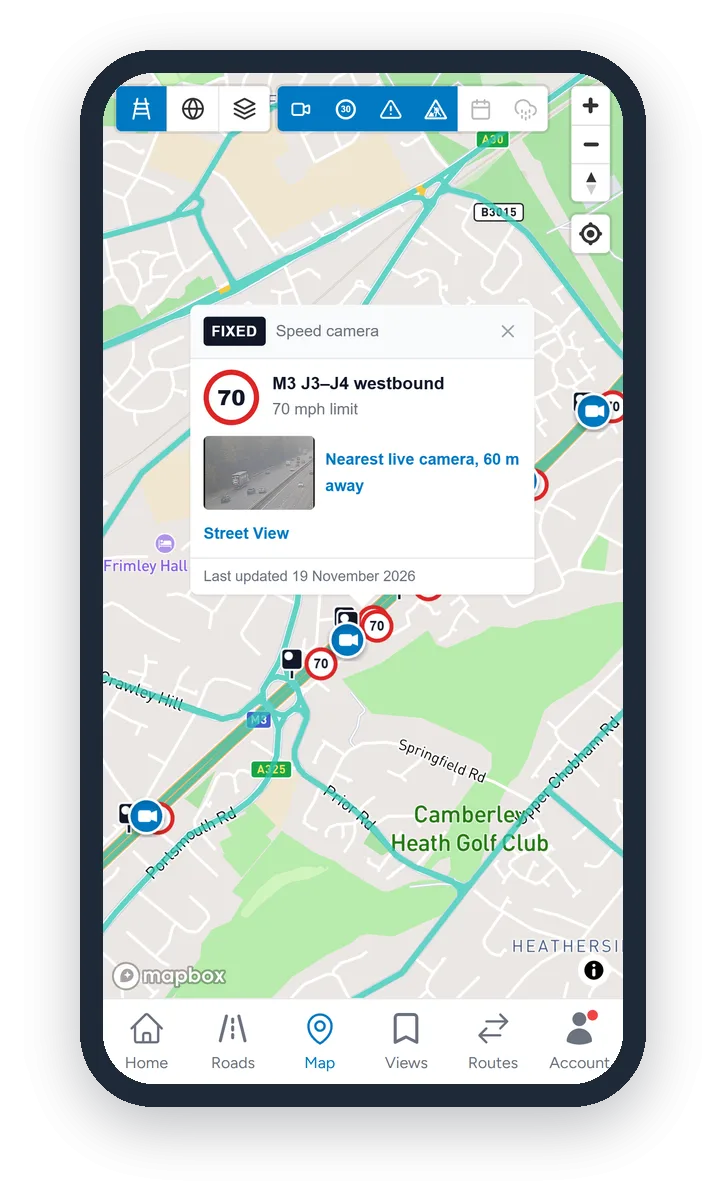
Zoomed out, the speed cameras are small black dots, so you can see where they are without them crowding the map. Zoom in and they turn into camera icons, and closer still each one shows its speed limit.
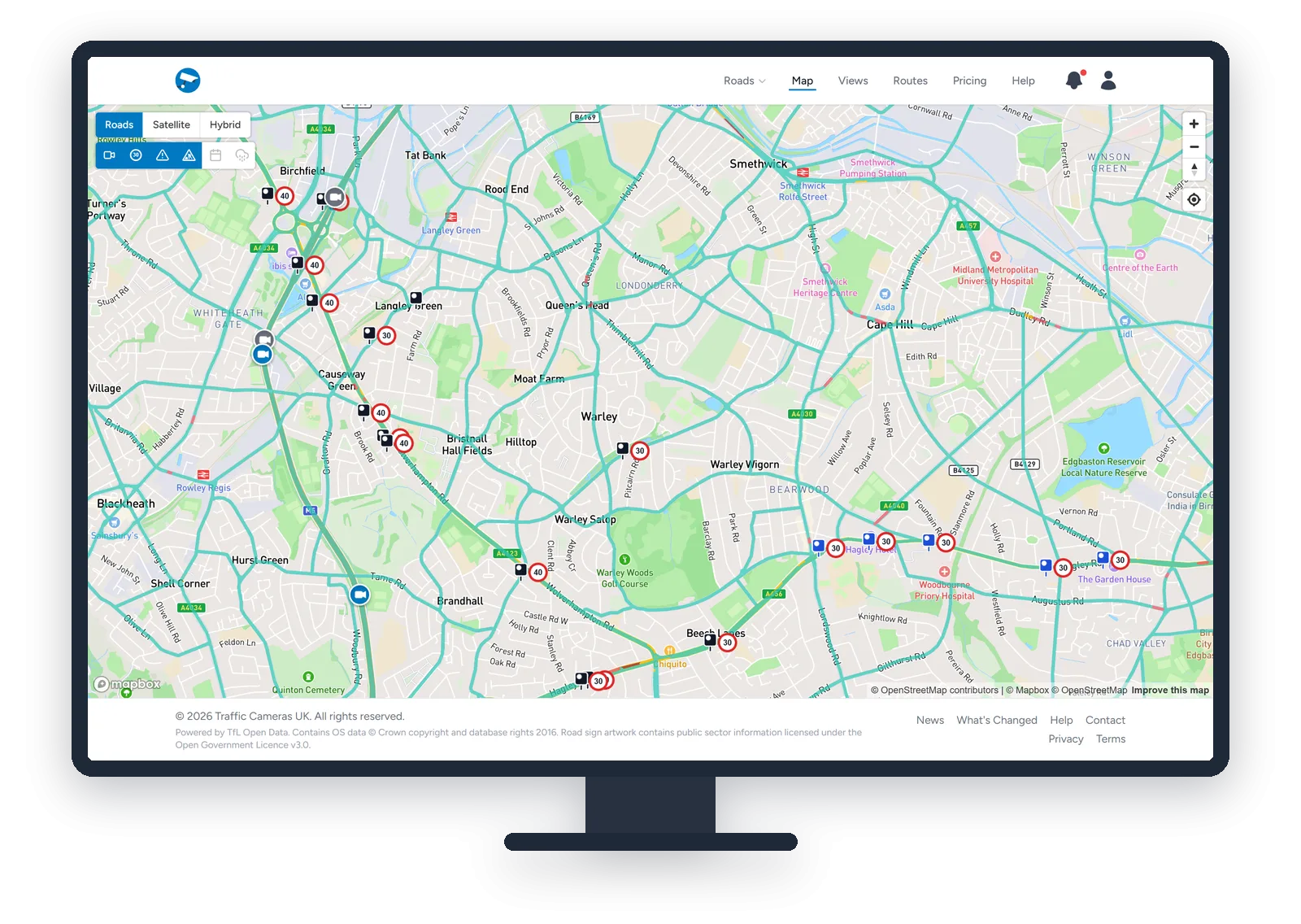
The colours tell you what kind of camera it is:
- Black: fixed speed cameras
- Blue: average speed cameras
- Red: red light cameras
Our own live traffic cameras stay on top, so you can switch between the two without losing your place.
Everything about each camera
Tap a speed camera and you get the details:
- The road, the junctions it's between and the direction it faces, like "M3 J3–J4 westbound"
- The speed limit
- For average speed zones, how long the zone is and how long it takes at the limit
- The nearest live traffic camera, with its latest picture. Tap it to see what the traffic's doing there right now.
- A Street View link, so you can see exactly what the spot looks like
On the camera pages too
You don't even need the map. When one of our live cameras has a speed camera close by, you'll see a small speed camera icon with the limit in the bottom-left corner of the camera picture, on road pages, Views and Smart Routes. Tap it to see what kind of camera it is and how far away, and jump to it on the map.
Who can see them
- The map layer: anyone with a free account. Sign up here if you haven't already.
- Smart Routes: Commuter and Professional members get the same speed camera layer on their route maps.
- The icon on camera pictures: everyone.
Where the information comes from
The speed camera locations are collated from public sources and refreshed every month, so new cameras are added and removed ones drop off as the sources are updated.
It's a helpful guide rather than the final word. Cameras get added, moved and switched off all the time, mobile camera vans aren't included, and a camera on the map may not be active. If there's no camera on the map, that doesn't mean there isn't one. The speed limit is always whatever the road signs say. Keep to the limit everywhere, and never use your phone while driving.